
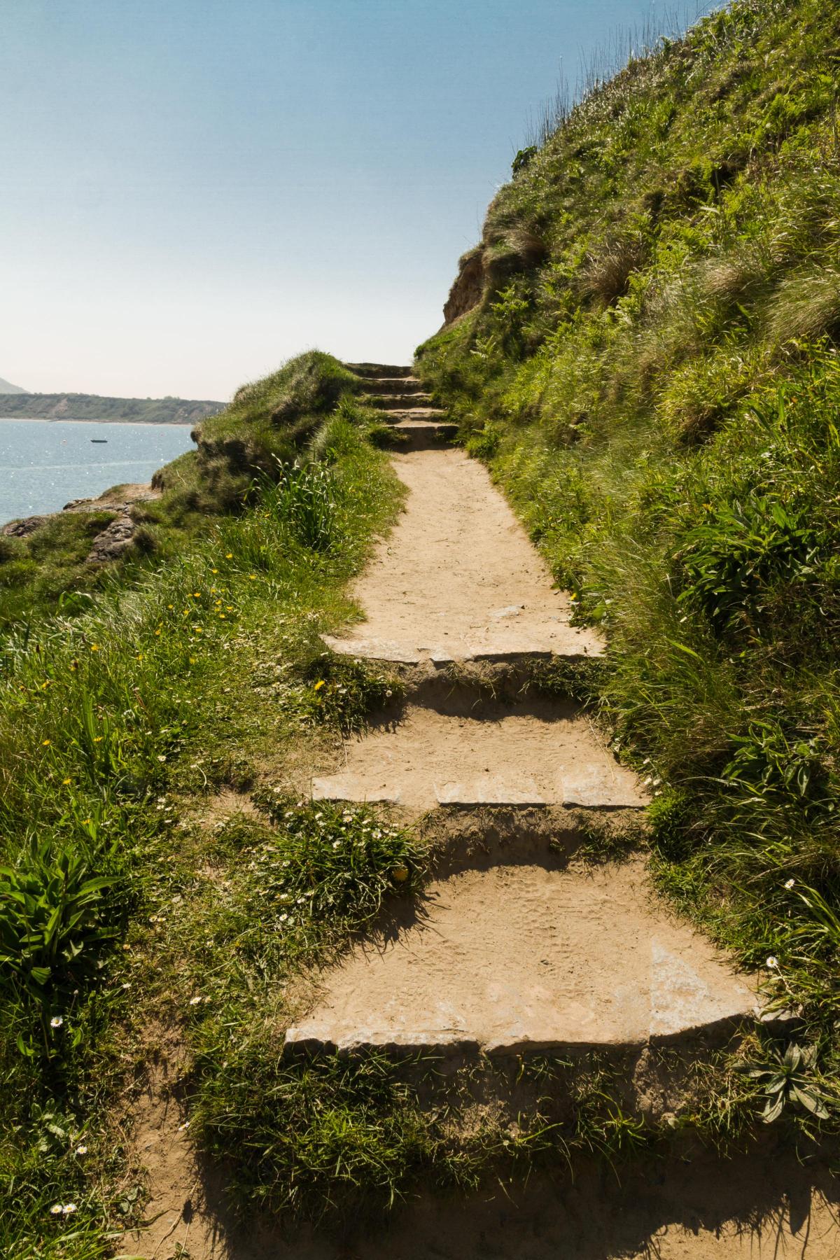
A delightful walk on gentle footpaths to Lleyn's most unusual and picturesque settlement. In clear conditions there are stunning views of Yr Eifl (Rivals) across the bay and inland from the end of the headland. Footpaths are excellent throughout.
Distance: 4½ miles
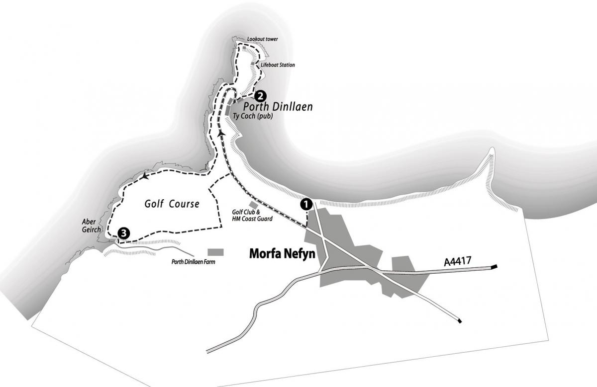
Start: There is a large National Trust car park at the end of Lon Golf (Golf Lane) in Morfa Nefyn and a good pub on the route, Ty Coch Inn in Porth Dinllaen - an ideal place to enjoy a drink or lunch en-route (to check opening times visit the website: www.tycoch.co.uk).
Grid ref: 282 407 (Landranger 123, Explorer 253).
The walk
1. Turn right out of the car park and follow the road to the golf club and the RNLI House. Go through the gate onto the golf course and follow the narrow tarmac road across the golf course and down to Porth Dinllaen. Rights of way do exist off to the right as you near
Porth Dinllaen but they are not waymarked and it is easier to follow the road.
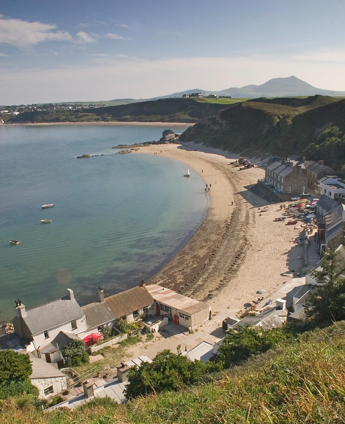
It is hard to believe, as you walk through this tiny remote hamlet, that in the 18th and early 19th centuries it was set to become one of the busiest sea ports in North Wales and for a time even rivalled Holyhead as the ferry port for Ireland.
During this period it had a shipyard and hotels to cater for travellers and plans were laid for rapid expansion. This sheltered bay, protected
from westerly gales by the long promontory of Trwyn Porth Dinllaen, has long been used as an anchorage and as far back as the 16th century ships were regularly unloading here. In 1648 the Postmaster General ordered the Irish mail to travel via Porth Dinllaen instead of
Holyhead.
By the late 18th century plans were afoot to improve the road from Montgomeryshire to Porthmadog, where William Alexander Madocks was shortly to build his great embankment across Traeth Mawr. This had previously acted as a major barrier to communications, involving travellers in a hazardous crossing of the tidal sands or a long detour through difficult mountainous terrain.
With the new road in place and a recently formed Harbour Company, Porth Dinllaen braced itself for great things. Prospects looked even more hopeful when a Parliamentary Bill was introduced to make Porth Dinllaen the packet port for Ireland replacing Holyhead.
Holyhead won the day by just one vote. This was not end however, with the coming of the railways new hopes were raised and in 1884 a Porth Dinllaen Railway Company was formed and given five years to build the 9¼ mile track to Pwllheli. For some unknown reason this was never accomplished. The isolated location of Porth Dinllaen and the rapid rise of Holyhead sealed its fate.
Today we can be grateful for its misfortune - this lovely spot has been largely untouched by the 20th century. The only boats you will see here today are small pleasure craft. And what a location, safe sheltered waters with an unrivalled backdrop of shapely peaks falling sheer to the sea. The robust, stone-built cottages provide holiday accommodation, and where else can you get a pint on the beach? We can only imagine with horror what the effect would have been on this and the surrounding coastline had Holyhead not won the day.
2. Beyond the Ty Coch Inn a narrow footpath passes between cottages before continuing just above the high water mark.
At the lifeboat station bear left up the access road and where this swings sharp left at the top of the rise, bear right onto a higher path. Continue around the coast which is now more exposed and rugged before rising to an old lookout tower. The lookout is well placed
with commanding views of Caernarfon Bay - from Holyhead Mountain on Anglesey all the way to the southwestern tip of Lleyn.
The sheltered bay at Porth Dinllaen is the only safe haven on this entire coast, some 50 miles of jagged rocks and treacherous sands. In 1864, when the first lifeboat station was established, over 200 ships had been lost in the Port Dinllaen area in just 25 years.
By 1881 the lifeboat had made 31 launches and saved 91 lives, even so it received public criticism for failing to go to the aid of the SS Cyprian. This wreck was made famous by the bravery of the captain who sacrificed his own life so that a young stowaway might live.
Pass below the lookout tower, then keep along the very edge of the golf course. Continue for 1½ miles.
3. At a small bay with a pipeline running into the water, turn inland and cross a stile out of the golf course. Follow the path into, then
along a little valley beside the stream on the right ignoring a small footbridge (the continuation of the coastal path).
The stream soon bends right but the path continues ahead. Where the path bears to the right, go through a kissing gate ahead into fields.
Bear left and walk beside the fence with a farm away to the right and the golf course on the left. At the next stile drop into a narrow path enclosed by high earth banks. Turn left through a kissing gate and follow the path until it opens out onto the golf course. At the end of the bank on your left, turn sharp right and cross the golf course aiming for a large shed beside the road used earlier in the walk to reach Porth Dinllaen. Turn right along the road and retrace the outward journey to complete the walk.
This walk is taken from The Official Guide to the Lleyn Peninsula section of the Wales Coast Path (ISBN 978-908632-24-1). Copies can be ordered from bookshops or purchased online at: www.northerneyebooks.co.uk.


Comments: Our rules
We want our comments to be a lively and valuable part of our community - a place where readers can debate and engage with the most important local issues. The ability to comment on our stories is a privilege, not a right, however, and that privilege may be withdrawn if it is abused or misused.
Please report any comments that break our rules.
Read the rules here