
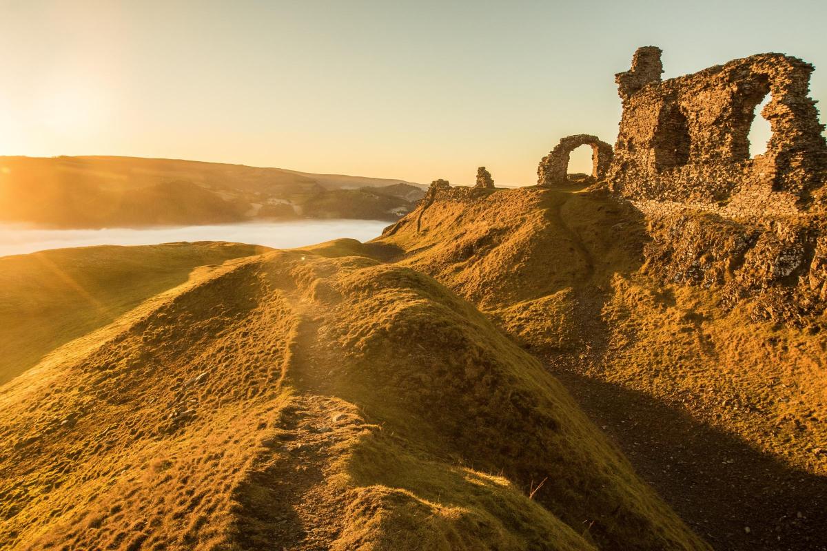
Up to ruined Castell Dinas Bran and along the dramatic limestone escarpment beyond Trevor Rocks, with magnificent views.
Start: Begin the walk at Llangollen's main, fee paying car park situated in Market Street (just off Castle Street) which leads down to the
bridge.
Map reference: SJ 215 420.
Distance: 8 kilometres/5 miles.
Food and Drink: Numerous pubs, wine bars, restaurants, cafés, teashops and takeaways in Llangollen.
Map: OS 1: 50,000 Landranger 117 Chester & Wrexham; OS 1:25,000 Explorer 256 Wrexham & Llangollen.
The walk:
1. Turn right out of the car park, and at the end of the road turn left down Castle Street, to cross over the old Dee bridge.
Turn right, opposite the Bridge End Hotel, cross the road then, within 50 metres, bear left up Wharf Hill. Cross the Llangollen Branch of the Shropshire Union Canal and take the enclosed footpath, up steps, straight ahead; it's signposted to the Offa's Dyke Path.
The path runs uphill beside the local High School. At the top, go through the gate, cross a metalled lane, and continue to climb uphill,
through the fields, on a narrow surfaced path beside the hedge. A gate in the top corner leads onto an unmetalled access road, follow
this and keep straight ahead at a crossroads by a group of cottages.
At the top of the lane, a gate leads out onto the hillside and a sign to Castell Dinas Bran directs you half-right. Follow this path over
the rise and, after a short dip, a steepening zig-zag path takes you up the neat, sheepcropped slopes to the crumbling ruins that crown the highest point.
2. From the castle ruins, a well marked path descends the eastern slopes of the hill, on the opposite side to the ascent, with a fine view
of the Dee valley and Telford's multi-arched aqueduct in the distance, to join a narrow lane below the limestone terraces of Trevor
Rocks. Turn left here, then after a few metres turn right at a T junction. This section of road is part of the Offa's Dyke Path (see the OS
1:25,000 Explorer map). Follow the narrow lane gently uphill, as it contours the hillside below the limestone cliffs. When the lane
forks, 300 metres later, take the left-hand, upper road.
Five hundred metres or so further on, the lane doglegs sharply around to the left. Immediately before the lane kinks to the right again, turn left, uphill on a broad, signposted path. Follow the path as it rises gently to a gate. Bear left before the gate and follow the fenceline diagonally uphill to the edge of the limestone cliffs.
As the pines peter out, the clifftop path curves to the right, into a V-shaped stream valley cut into the limestone bluffs. At the top of this indentation, a three way wooden fingerpost indicates the way ahead, back, and up to the right. Our route, however, turns sharp left here, to descend through this natural gap in the cliffs. A narrow path runs downhill through the bracken beside a crumbling stone wall and stream. Lower down you are forced to make a short but easy scramble over a low, wet rock step; the driest routes are to either side.
Immediately below the rock step, cross to the right and look for a narrow path directly below the sheer rock face. Don't drop too far
down the hillside. Once found, the path is clear. It snakes diagonally to the right, downhill through stunted hawthorn and gorse bushes, then crosses screes to the road below. Watch your footing and take care on this section of the route.
3. This attractive lane is part of the Offa's Dyke Path. If you managed to find the correct path down the hillside, directly across the road there should be a field gate and signposted stile. If, however, you followed the stream down to the road, then turn right and walk up the lane to find the gate and stile just off the road to the left.
Climb the stile and cross the field to the far right-hand corner, ignoring a stile to the left below an old lime kiln. Go through the gate
and continue on the farm track ahead, through two more gates. When the track forks, bear to the right, and follow the public right of way through the farmyard to Dinbren Isaf farm. Walk past the old farmhouse with its topiary hedges, and continue down the concrete access drive to a quiet country lane. Turn left here, downhill, and after about 100 metres, climb over a signposted ladder stile in the hedge on the left. Follow the field edge path downhill beside a wooded stream valley.
Watch out for a crude wooden footbridge on the left; cross over and then bear right, gently downhill beneath the trees, with the stream now on your right. Roughly 200 metres later, at a large field gate, bear half-left to a stile to follow an attractive path through open woods, with fields down to the right. At a rough farm track, cross over and go down steps to continue through the trees to a lane.
Turn left here, downhill. When the lane bends to the right, 50 metres later, turn left onto a field path signposted for the Llangollen History Trail. Keep left around the field edge, with Castell Dinas Bran on its hill now directly ahead. Climb over a stile in the top right hand corner of the field, and then bear right on a shady, uphill path beside the hedge.
At the top of the rise, a gate leads back onto the access track used earlier in the walk to reach the castle. Retrace your steps back to Llangollen. Alternatively, this last section can be avoided by continuing along the lane back to Llangollen to complete the walk.
This walk is supplied by Carl Rogers and taken from his Best Walks in North Wales (ISBN 978-0-9553557-3-8) published by Northern Eye Books (www.northerneyebooks.com) £8.99.


Comments: Our rules
We want our comments to be a lively and valuable part of our community - a place where readers can debate and engage with the most important local issues. The ability to comment on our stories is a privilege, not a right, however, and that privilege may be withdrawn if it is abused or misused.
Please report any comments that break our rules.
Read the rules here