
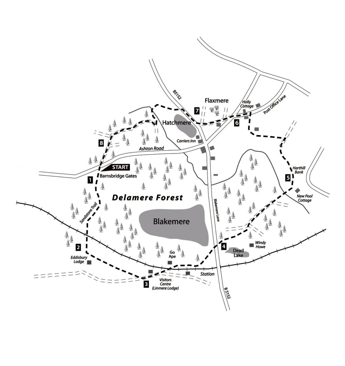
Sandstone Trail, Linmere Lodge Visitor Centre, Harthill Bank, Hatchmere
Start: Barnsbridge Gates car park, on Ashton Road in the centre of Delamere Forest. Map reference: SJ 542716.
Distance: 6 miles/9.5 kilometres.
Map: OS 1:25,000 Explorer 267 Northwich & Delamere Forest.
The walk
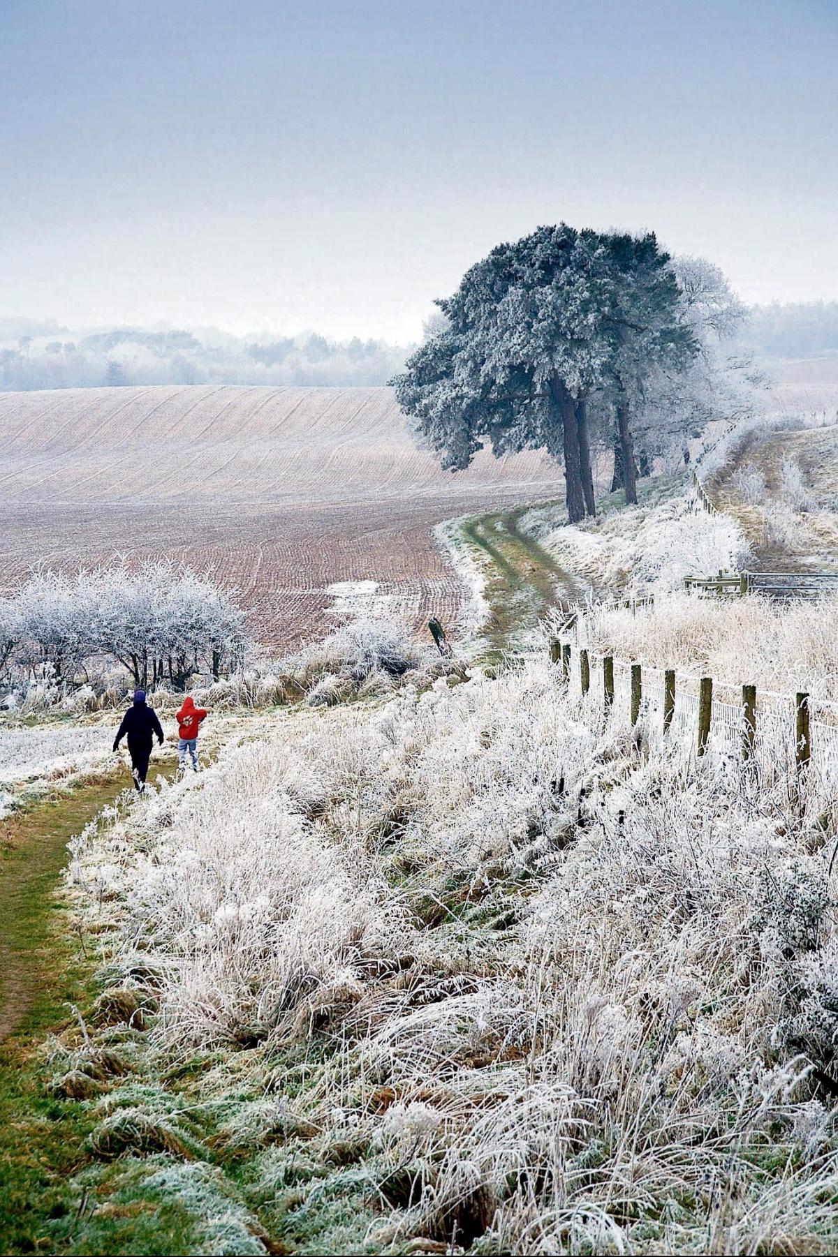
1. From the car park, climb steps and turn left along the Sandstone Trail. Keep right, following its markers straight on at the next crossroads and the next fork, to the railway bridge. Delamere Forest covers 4,000 acres/1,600 hectares of Cheshire today, but many centuries ago, when the Celts camped here, it was three times the size, covering the land from Nantwich to Helsby. In the Middle Ages it was made into the twin royal forests of Mara and Mondrem.
It seems incongruous to hear the hoot of a diesel in this quiet area but this is the Chester-Manchester line. Constructed in the 1870s, it was one of only a few lines built and owned by a committee - the Cheshire Lines Committee. It was also the last line to be brought into British Rail in 1947 - six months after the rest because of an oversight.
2. Keep ahead again at a junction of paths. Then leave the Sandstone Trail, bearing left where this continues through a gap in a fence. This is just before you reach Eddisbury Lodge, which takes its name from a hunting lodge situated here when the forest provided sport for the Norman nobility. Continue along this wide path, uphill at first, then passing seats and walking parallel with the railway line until you come to a tarmac road and turn left. A ridge of hills rolls away nearby. The summit of Eddisbury Hill is the highest point, where the remains of an ancient fortress can be found.
3. You soon arrive at Linmere Lodge visitor centre with its gift shop, cafe and toilets. Just past here, turn left to re-cross the railway, then turn sharp right, walking behind the 'Go Ape' hut. Advertised as a high wire forest adventure at tree-top height, it includes rope bridges, Tarzan swings and zip slides. So if you fancy shinning up trees on rope ladders and whizzing down a steel wire, then this is definitely for you! Continue through the wood parallel with the railway line. The wide path soon narrows and winds between the trees, the leaf mould underfoot providing a soft surface for one's long-suffering feet! As you pass cottages built for railway employees, the path veers left with a field on the right.
4. Arriving at Blakemere Lane (B5152), cross over and continue towards Whitefield car park. An expanse of water, Dead Lake, shimmers up through the trees and then you can glimpse Windy Howe perched on the hillside. Where the track branches left to the car park you keep ahead through clearings dominated by massive beech trees, their far-reaching horizontal branches guarding their territory. These give way to younger beeches on either side of the path, the tangle of their roots so shallow that they often protrude above the surface and are easy to trip over. Keep ahead onto a much wider track, dropping downhill as silver birches drop away down the valley on your right. Keep ahead at the first junction and climb up to another, where you bear slightly left up over the hill. This brings you out of the main forest and you continue forward between fields.
5. When you reach New Pool Cottage turn left through a gate, walking down a grassy track along the hillside known as Harthill Bank. Cross a small stream and a stile before bearing left uphill and continuing along the path to the facing hedge. Turn right here, continuing along the side of two fields until you are on the grassy track again, which leads down into a small valley.
Turn left along an almost hidden path in front of the next gate and walk along the bottom of the field until you come to a steel gate into the next one. From here walk alongside the hawthorn hedge to a farm. Turn right down the farm track for a short distance before bearing left at the brick barn over a stile into a field. Walk up along the hedge to Post Office Lane where you turn left.
6. At the fork continue ahead down the rough road to Hatchmere and, where this splits, go ahead again and bear left.
The area of land over to the right is called Flaxmere. It used to be a lake in the 13th century but is now reduced to a sunken moss.
The track finishes at a cottage inscribed with the date 1833 and the builder's initials. Keep ahead down a footpath here, then turn left down a dirt road as pretty reed-fringed Hatchmere comes into view. There is a car park and toilets here, opposite the Carriers Inn which has been a pub for over 300 years. Important breeding birds on this acidic lake include great crested grebe, reed bunting and willow warbler.
7. Turn right along the B5152 and, where the mere ends, turn left along a clearly-marked path. Stay on this as it continues to the edge of the forest. Cross the bridge over one stream, then turn left alongside a second. The area here may be boggy as you follow the stream until you reach a wooden bridge over it. Cross this and climb straight up the hill ahead to a broad forest 'ride'. Turn right along this, enjoying its grassy border and soft surface strewn with pine needles. Stay on this main track, ignoring any small enticing paths through the trees. Turn right when you come to a T-junction, dropping downhill before the track winds left again and takes you to the edge of the forest and a field on your right. (There's a seat at this point.)
8. Continue alongside the field, ignoring a stile on your right as you turn back into the forest. Finally, continue forward on a broad track and you will soon be back at Barnsbridge Gates.
This walk is taken from the book 'Walks in West Cheshire and Wirral' by Jen Darling, £8.99 (ISBN 978-0-9553557-2-1). Copies can be obtained online at: www.northerneyebook.co.uk, or from local bookshops.


Comments: Our rules
We want our comments to be a lively and valuable part of our community - a place where readers can debate and engage with the most important local issues. The ability to comment on our stories is a privilege, not a right, however, and that privilege may be withdrawn if it is abused or misused.
Please report any comments that break our rules.
Read the rules here